Vraja-maṇḍala parikramā (84 kos)
The places of the parikramā of the whole of Vraja in the order of the guidebook Śrī Vraja-maṇḍala Parikramā, beginning in Śrī Mathurā.[1]
On this page
Walking guide
85 of the 212 stops have a position in our own map data (not from Google). The guide leads you from one of these stops to the next and skips the others.
Your position stays on your phone; we do not store it.
About this route
| Eighty-four kos | Śrīla Prabhupāda writes that the land of Vraja is divided into twelve forests whose extent is estimated at eighty-four krośas (kos).[2] |
|---|---|
| The yearly walk | According to the guidebook Vṛndāvana-Dhāma Ki Jaya! (c. 1986), thousands of pilgrims go round Vraja every autumn. They begin at Viśrāma-ghāṭa in Mathurā, go clockwise through the whole of Vraja-maṇḍala and take about one month.[3] |
| Order | As printed in the guidebook’s list of the places visited on Vraja-maṇḍala parikramā (212 names). The book says that some places appear more than once because there are often alternative routes. This is the book’s order, not a checked walking route. |
Map of the stops
The interactive map uses Google Maps. It loads only when you open it. Each pin carries the number of its stop.
93 of the 212 stops are on this map. 8 of these pins show a position from Google that we have not confirmed; the walking guide uses only the other 85.
- confirmed position
- position not yet confirmed (preview only)
- position from Google (not confirmed by us)
The stations
The Google Maps links open Google’s own result for each place.
Jump to a stop stops 1–212
- 1
- 2
- 3
- 4
- 5
- 6
- 7
- 8
- 9
- 10
- 11
- 12
- 13
- 14
- 15
- 16
- 17
- 18
- 19
- 20
- 21
- 22
- 23
- 24
- 25
- 26
- 27
- 28
- 29
- 30
- 31
- 32
- 33
- 34
- 35
- 36
- 37
- 38
- 39
- 40
- 41
- 42
- 43
- 44
- 45
- 46
- 47
- 48
- 49
- 50
- 51
- 52
- 53
- 54
- 55
- 56
- 57
- 58
- 59
- 60
- 61
- 62
- 63
- 64
- 65
- 66
- 67
- 68
- 69
- 70
- 71
- 72
- 73
- 74
- 75
- 76
- 77
- 78
- 79
- 80
- 81
- 82
- 83
- 84
- 85
- 86
- 87
- 88
- 89
- 90
- 91
- 92
- 93
- 94
- 95
- 96
- 97
- 98
- 99
- 100
- 101
- 102
- 103
- 104
- 105
- 106
- 107
- 108
- 109
- 110
- 111
- 112
- 113
- 114
- 115
- 116
- 117
- 118
- 119
- 120
- 121
- 122
- 123
- 124
- 125
- 126
- 127
- 128
- 129
- 130
- 131
- 132
- 133
- 134
- 135
- 136
- 137
- 138
- 139
- 140
- 141
- 142
- 143
- 144
- 145
- 146
- 147
- 148
- 149
- 150
- 151
- 152
- 153
- 154
- 155
- 156
- 157
- 158
- 159
- 160
- 161
- 162
- 163
- 164
- 165
- 166
- 167
- 168
- 169
- 170
- 171
- 172
- 173
- 174
- 175
- 176
- 177
- 178
- 179
- 180
- 181
- 182
- 183
- 184
- 185
- 186
- 187
- 188
- 189
- 190
- 191
- 192
- 193
- 194
- 195
- 196
- 197
- 198
- 199
- 200
- 201
- 202
- 203
- 204
- 205
- 206
- 207
- 208
- 209
- 210
- 211
- 212
On the walking guide
- 1
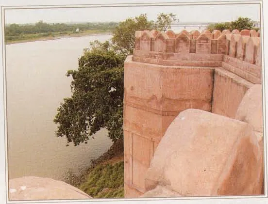
Mathurā
On the walking guideMathurā is the city on the Yamunā where Śrī Kṛṣṇa appeared from Devakī in the prison of King Kaṁsa.
Source details
printed: “Śrī Mathurā”
- 2
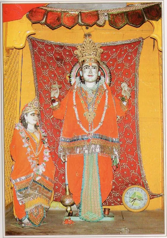
Madhuvana
On the walking guideMadhuvana, the forest of the demon Madhu, is one of the twelve forests of Vraja.
Source details
printed: “Madhuvana”
- 3
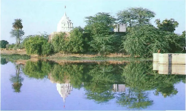
Tālavana
On the walking guideTālavana, the forest of tāla (palm) trees, is one of the twelve forests of Vraja and one of the seven on the western side of the Yamunā.
Source details
printed: “Tālavana”
- 4
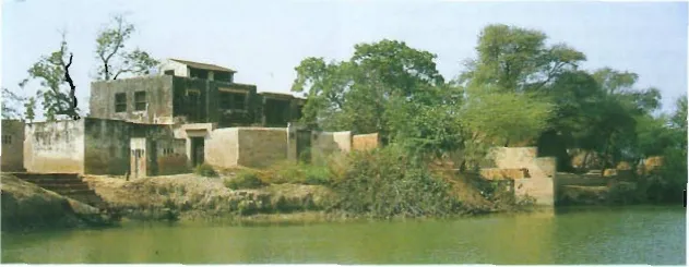
Kumudavana
On the walking guideKumudavana, the forest of the kumuda, the white water lily, is one of the twelve forests of Vraja and one of the seven on the western side of the Yamunā.
Source details
printed: “Kumudavana”
- 5
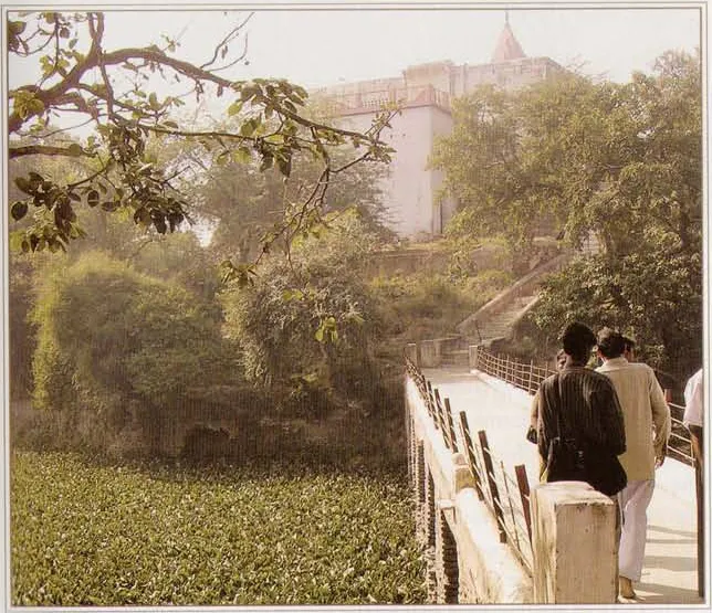
Śāntanu-kuṇḍa (Satohā)
On the walking guideŚāntanu-kuṇḍa is a large kuṇḍa (sacred pond) beside the village of Satohā, on the Govardhana road.
Source details
printed: “Śāntanu-kuṇḍa”
- 6
Gandheśvarī
On the walking guideGandheśvarī is a village on the old route from Śāntanu-kuṇḍa to Bahulāvana, known today as Gaṇeśarā.
Source details
printed: “Gandheśvara”
- 7
Bahulāvana
Bahulāvana is one of the twelve forests of Vraja and one of the seven on the western side of the Yamunā.
Source details
printed: “Bahulāvana”
- 8
Rāla-grāma
On the walking guideRāla-grāma, now also called Rāra-grāma, is a village near Basauntī, according to the guidebook Śrī Vraja-maṇḍala Parikramā (2007).
Source details
printed: “Rāl”
- 9
- 10
Jainta
On the walking guideJainta, called Jayeta in the Bhakti-ratnākara, is a village.
Source details
printed: “Jaita”
- 11
Śakaṭīkarā
On the walking guideŚakaṭīkarā, now called Chaṭṭīkarā, is a village on the Delhi–Mathurā highway, about four miles from Mathurā and two miles from Vṛndāvana, according to the guidebook Śrī Vraja-maṇḍala Parikramā (2007).
Source details
printed: “Śakaṭīkarā (Chaṭṭīkarā)”
- 12
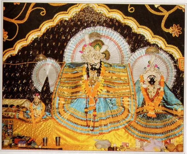
Garuḍa-Govinda
Garuḍa-Govinda is a temple near the village of Śakaṭīkarā (Chaṭīkarā).
Source details
printed: “Garuḍa-Govinda”
- 13
Bahulāvana
Bahulāvana is one of the twelve forests of Vraja and one of the seven on the western side of the Yamunā.
Source details
printed: “Bahulāvana”
- 14
- 15
Datihā
On the walking guideDatihā, also called Datīya, is a village west of Mathurā.
Source details
printed: “Datihā (Datīyā)”
- 16
Aḍīṅga
Aḍīṅga (Aring) is a village on the main road from Mathurā to Govardhana.
Source details
printed: “Aḍiga”
- 17
Mādhurī-kuṇḍa (Aḍīṅga)
Mādhurī-kuṇḍa is a pond south-east of Aḍīṅga.
Source details
printed: “Mādhurī-kuṇḍa”
- 18
Jakhina-grāma
Jakhina-grāma is a village of Bahulāvana, with a Balabhadra-kuṇḍa and Deities of Baladeva and His wife Revatī.
Source details
printed: “Jakhīna-gaon”
- 19
Toṣa-gaon
On the walking guideToṣa-gaon is a village of Vraja whose name means satisfaction (toṣa).
Source details
printed: “Toṣa”
- 20
- 21
- 22
Mukharāī
Mukharāī is a village about one mile south of Rādhā-kuṇḍa, on the road to Vṛndāvana, according to the guidebook Śrī Vraja-maṇḍala Parikramā (2007).
Source details
printed: “Mukharāī”
- 23
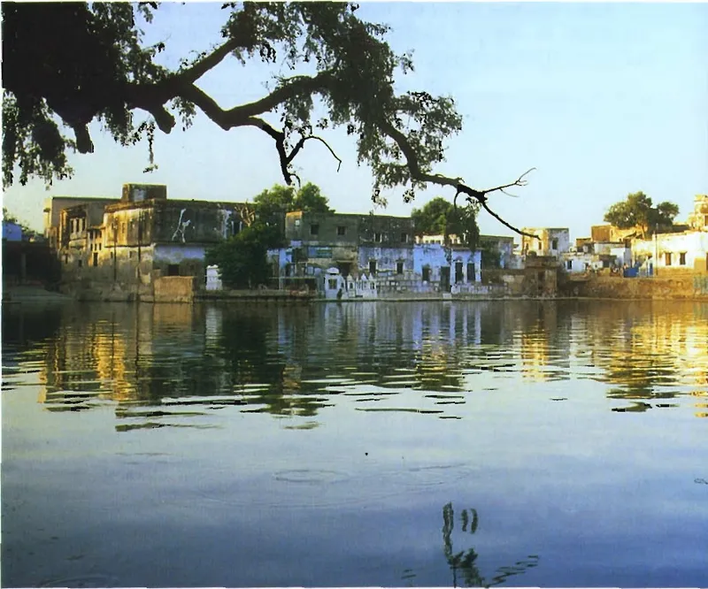
Rādhā-kuṇḍa
On the walking guideRādhā-kuṇḍa is the lake of Śrī Rādhā at the foot of Govardhana Hill, in the village of Āriṭa.
Source details
printed: “Śrī Rādhā-kuṇḍa”
- 24
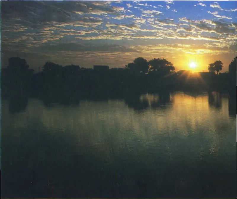
Śyāma-kuṇḍa (Rādhā-kuṇḍa)
On the walking guideŚyāma-kuṇḍa, also called Kṛṣṇa-kuṇḍa, is Kṛṣṇa's lake beside Rādhā-kuṇḍa at the foot of Govardhana Hill.
Source details
printed: “Śrī Śyāma-kuṇḍa”
- 25
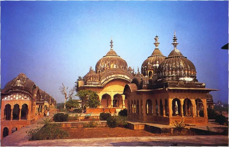
Kusuma-sarovara
On the walking guideKusuma-sarovara lies on the right of the Govardhana parikramā path, about one and a half miles south-west of Rādhā-kuṇḍa, according to Śrī Vraja-maṇḍala Parikramā (2007).
Source details
printed: “Kusuma-sarovara”
- 26
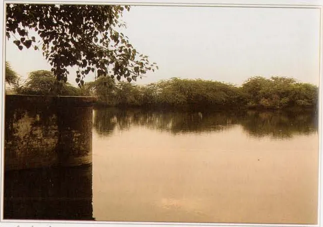
Nārada-kuṇḍa (Govardhana)
Nārada-kuṇḍa is a kuṇḍa (sacred pond) on the Govardhana circuit, south-east of Kusuma-sarovara, with a temple and Deity of Śrī Nārada Muni beside it.
Source details
printed: “Nārada-kuṇḍa”
- 27
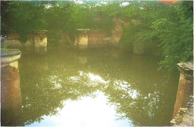
Gvāla-pokharā
Gvāla-pokharā is a small pond on Govardhana Hill.
Source details
printed: “Gvālā-puṣkariṇi”
- 28
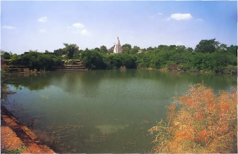
Jugal-kuṇḍa
Jugal-kuṇḍa is a small kuṇḍa (sacred pond) on the parikramā, the walk around Govardhana Hill.
Source details
printed: “Yugala-kuṇḍa”
- 29
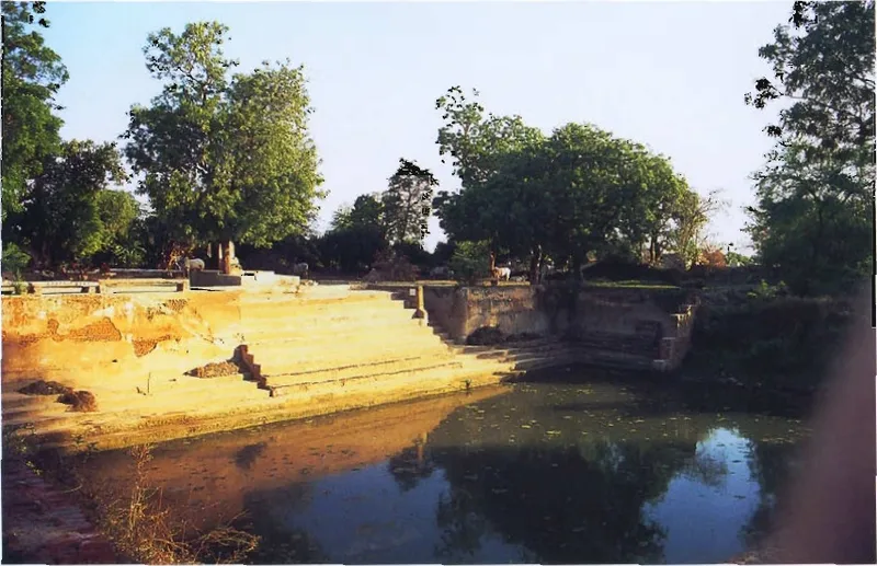
Killola-kuṇḍa (Govardhana)
Killola-kuṇḍa, also written Kilola-kuṇḍa, is a small pond a short distance from the main Govardhana parikramā path, south of Gvāla-pokharā.
Source details
printed: “Killola-kuṇḍa”
- 30
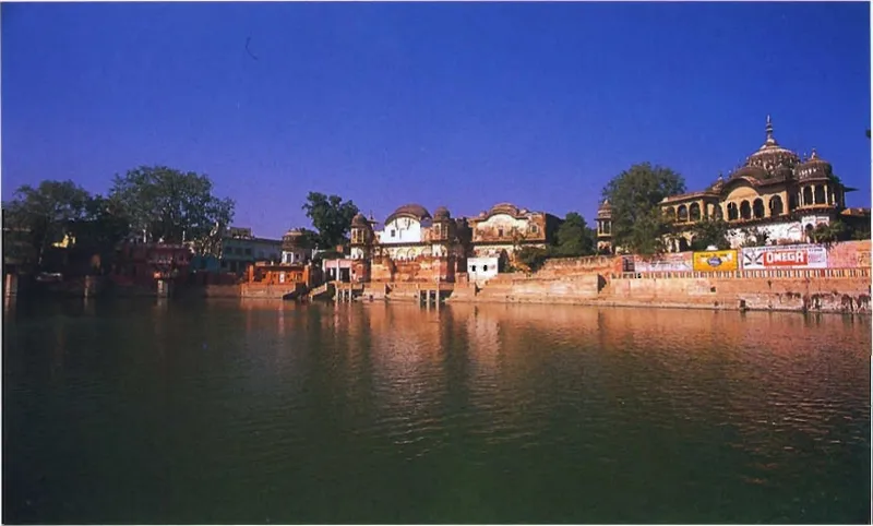
Mānasī-gaṅgā
On the walking guideMānasī-gaṅgā is the large lake in the middle of Govardhana town, on Govardhana Hill.
Source details
printed: “Mānasī-gaṅgā”
- 31
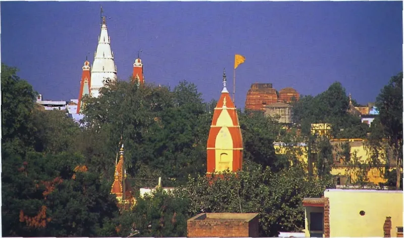
Govardhana (town)
On the walking guideGovardhana town lies at Govardhana Hill, around the lake Mānasī-gaṅgā, which the guidebook Govardhana Hill (2001) places in the middle of the town.
Source details
printed: “the town of Govardhana”
- 32
Indradhvaja-vedī
Indradhvaja-vedī, the altar of Indra's banner, is the place on the circuit of Govardhana where, according to the Bhakti-ratnākara, Nanda Mahārāja used to perform the worship of Indra, the king of heaven.
Source details
printed: “Indradhvaja-vedī”
- 33
- 34
Pārāsaulī
Pārāsaulī is a village in the lowlands of Govardhana, about one and a quarter miles south-east of Govardhana town, according to the guidebook Śrī Vraja-maṇḍala Parikramā (2007).
Source details
printed: “Pārāsaulī”
- 35
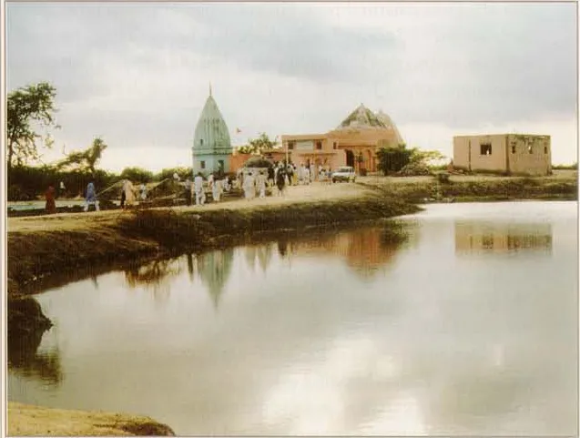
Paiṭhā-grāma
Paiṭhā is a village of the Govardhana area, two miles south of Pārāsaulī, according to the guidebook Śrī Vraja-maṇḍala Parikramā (2007).
Source details
printed: “Paiṭhā-gaon”
- 36
Bacha-gaon
Bacha-gaon, also called Vatsavana or Bachavana, is a village that the guidebook Śrī Vraja-maṇḍala Parikramā (2007) places three miles south of Paiṭhā, near Govardhana Hill.
Source details
printed: “Bacha-gaon (Vatsavana)”
- 37
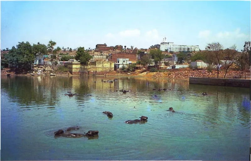
Aniyora
On the walking guideAniyora is a village near Govardhana Hill that present-day guides place on the parikramā path, the walk around the hill, south of the town of Govardhana.
Source details
printed: “Ānyora-gaon”
- 38
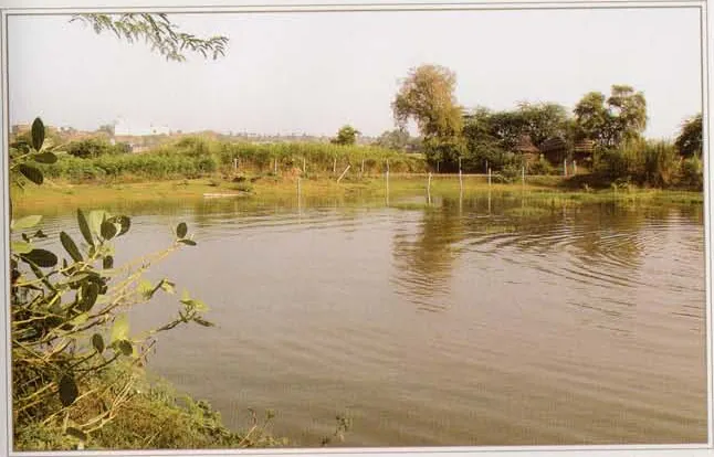
Gaurī-kuṇḍa (Govardhana)
Gaurī-kuṇḍa, also called Gaurī-tīrtha, is a pond on the circuit of Govardhana Hill, near Saṅkarṣaṇa-kuṇḍa and the village of Aniyora.
Source details
printed: “Gaurī-kuṇḍa”
- 39
- 40
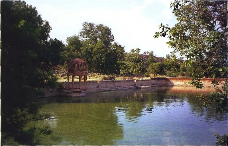
Govinda-kuṇḍa (Govardhana)
On the walking guideGovinda-kuṇḍa is a kuṇḍa (sacred pond) near the village of Aniyora on Govardhana Hill.
Source details
printed: “Govinda-kuṇḍa”
- 41
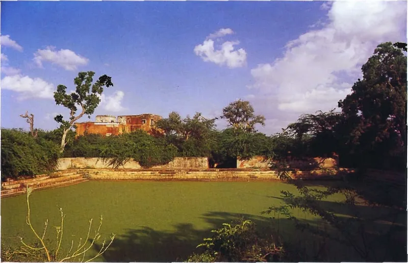
Navala-kuṇḍa
Navala-kuṇḍa is a pond just beside Apsarā-kuṇḍa at Pūñcharī, and a temple of Lord Narasiṁha stands on a small hill near its banks.
Source details
printed: “Navala-kuṇḍa”
- 42
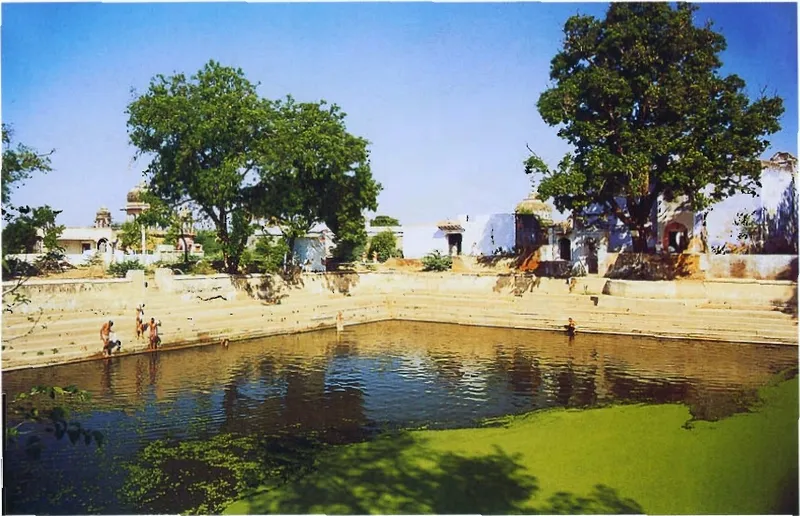
Apsarā-kuṇḍa
Apsarā-kuṇḍa, the kuṇḍa of the Apsarās, the dancers of heaven, is a pond at the southern end of Govardhana Hill.
Source details
printed: “Apsarā-kuṇḍa”
- 43
Śakra-kuṇḍa
Śakra-kuṇḍa (Indra's pond) is one of two ponds that Śrī Vraja-maṇḍala Parikramā (2007) places at Sauṅkarāī, now called Śakravā, two miles west of Govardhana, where, the book says, Indra gave Kṛṣṇa a Surabhi cow.
Source details
printed: “Śakra-kuṇḍa”
- 44
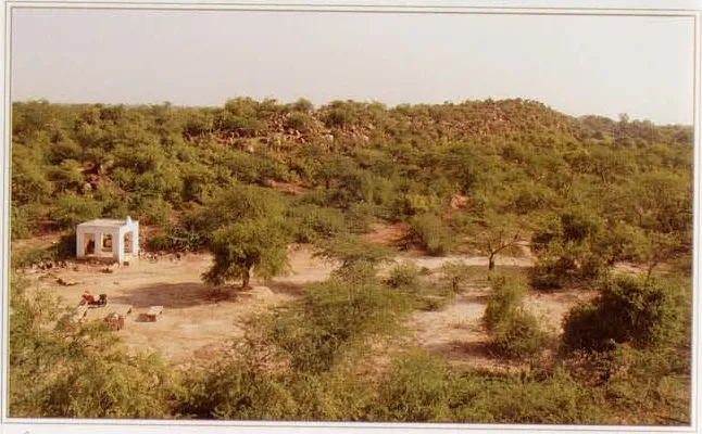
Pūñcharī
On the walking guidePūñcharī is the village at the southern end of Govardhana Hill, at the opposite end of the hill from Rādhā-kuṇḍa.
Source details
printed: “Pūñcharī”
- 45
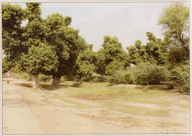
Śyāma-ḍhāka
On the walking guideŚyāma-ḍhāka is a grove of palāśa trees on the circuit of Govardhana Hill, which the guidebook Śrī Vraja-maṇḍala Parikramā (2007) places about a mile west of Pūñcharī.
Source details
printed: “Śyāma-ḍhāka”
- 46
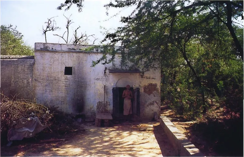
Rāghava Paṇḍita's cave
Rāghava Paṇḍita's cave lies near Apsarā-kuṇḍa at Govardhana, close to Pūñcharī, and the guidebooks call it the place of bhajana (chanting and worship) of Śrīla Rāghava Paṇḍita Gosvāmī of Govardhana.
Source details
printed: “Rāghava Paṇḍita's cave”
- 47
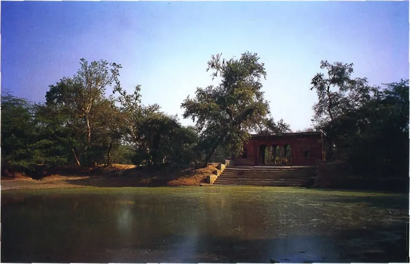
Surabhi-kuṇḍa (Govardhana)
On the walking guideSurabhi-kuṇḍa is a pond on the western side of the Govardhana circuit, in Kadamba-vana, and bears the name of Surabhi, the mother of the cows.
Source details
printed: “Surabhi-kuṇḍa”
- 48
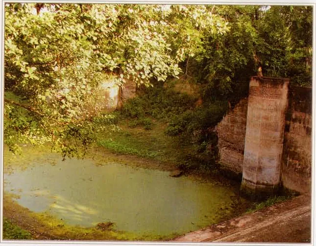
Airāvata-kuṇḍa
Airāvata-kuṇḍa is a pond that the guidebooks place in Kadamba Vana, on the western side of the walk around Govardhana Hill.
Source details
printed: “Airāvata-kuṇḍa”
- 49
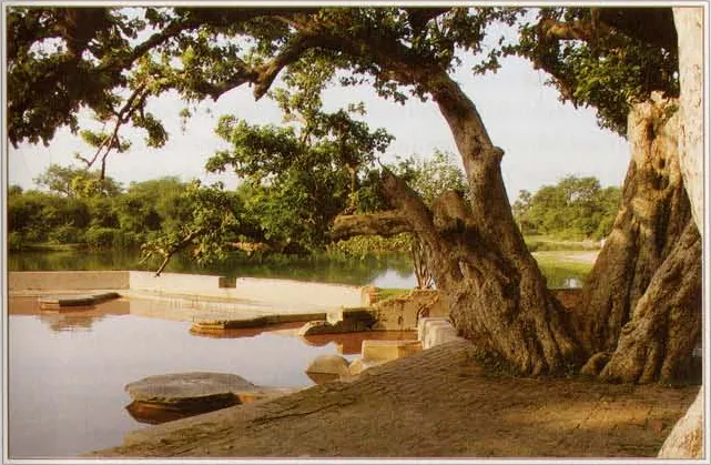
Rudra-kuṇḍa
Rudra-kuṇḍa is a pond at Govardhana, north-west of Airāvata-kuṇḍa according to Śrī Vraja-maṇḍala Parikramā (2007).
Source details
printed: “Haraji-kuṇḍa”
- 50
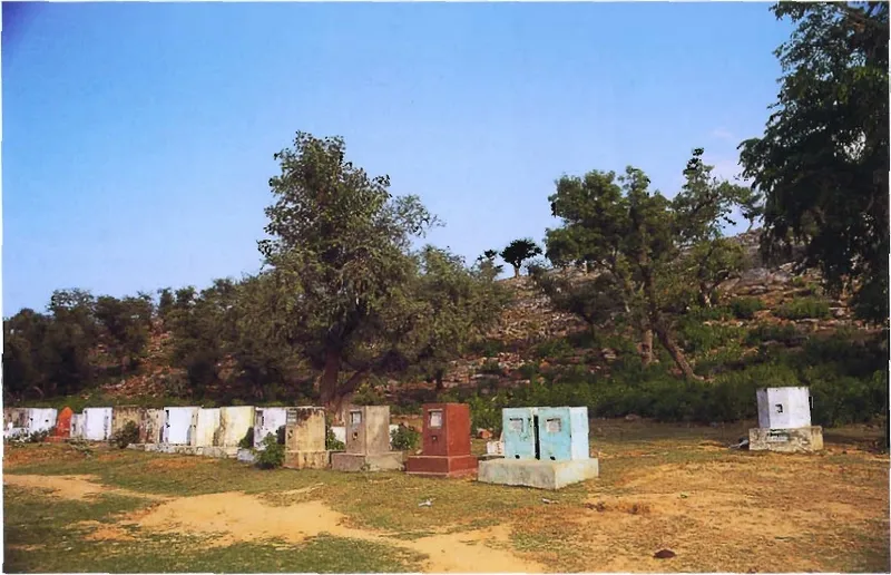
Jatīpurā
On the walking guideJatīpurā is a village on the west side of Govardhana Hill, across the hill from Aniyora; the Gopāla temple stands on the hilltop above it.
Source details
printed: “Jatīpurā”
- 51
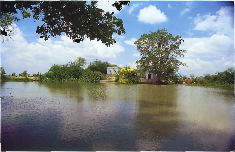
Vilachu-kuṇḍa
Vilachu-kuṇḍa, also written Bilachū-kuṇḍa, is a kuṇḍa (sacred pond) on the western side of the circuit of Govardhana Hill, just before Dāna-ghāṭī on the way into the town of Govardhana.
Source details
printed: “Bilachu-kuṇḍa”
- 52
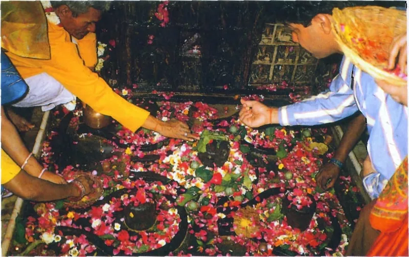
Cakaleśvara Mahādeva Mandira
The Cakaleśvara Mahādeva Mandira is a temple of Lord Śiva at Cakra-tīrtha, on the northern bank of Mānasī-gaṅgā in Govardhana town.
Source details
printed: “Cakreśvara Mahādeva”
- 53
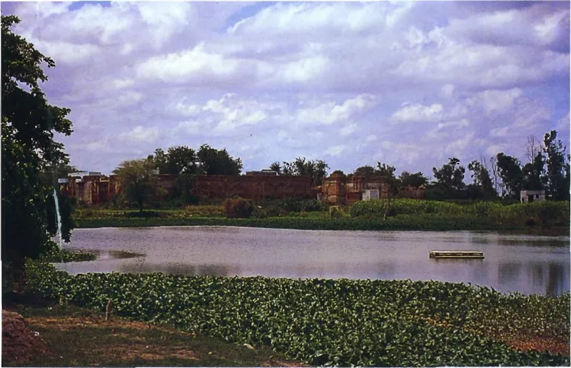
Sakhī-sthalī
Sakhī-sthalī, the place of the sakhīs (girl companions), is the village now called Sakhītharā near Govardhana.
Source details
printed: “Sakhī-sthalī”
- 54
Nīma-gaon
Nīma-gaon is a village on the road from Govardhana to Varṣāṇā, about two miles west of Govardhana town, according to the guidebook Śrī Vraja-maṇḍala Parikramā (2007).
Source details
printed: “Nīma-gaon”
- 55
Pāṭala-grāma
Pāṭala-grāma, now called Pāḍara, is a village two miles north of Nīma-gaon, according to the guidebook Śrī Vraja-maṇḍala Parikramā (2007).
Source details
printed: “Pāḍara”
- 56
Navā-grāma
On the walking guideNavā-grāma, now called Kuñjerā, is a village that the Bhakti-ratnākara and the guidebook Śrī Vraja-maṇḍala Parikramā (2007) give as the place where the kuñjas, the groves, of Rādhā-kuṇḍa end.
Source details
printed: “Kuñjerā”
- 57
- 58
Ḍerāvalī
Ḍerāvalī is a village that the Bhakti-ratnākara counts among the places near Rādhā-kuṇḍa.
Source details
printed: “Ḍerāvali”
- 59
- 60
Sahāra
On the walking guideSahāra, which the older works spell Sāhāra, is a village of Vraja south of Sāṅkhī.
Source details
printed: “Sāhāra”
- 61
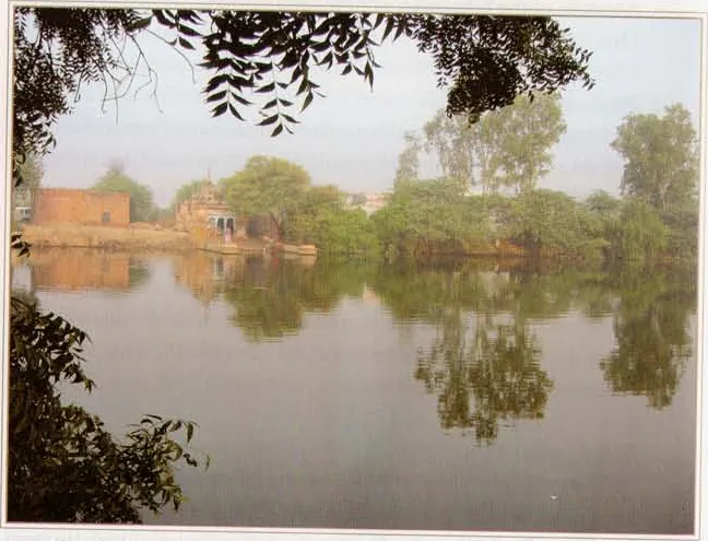
Sūrya-kuṇḍa (Choṭā Bharanā)
On the walking guideSūrya-kuṇḍa, the kuṇḍa of the Sun, lies north of Rādhā-kuṇḍa and is today also called Choṭā Bharanā; a temple of Sūryadeva, the sun-god, stands there.
Source details
printed: “Sūrya-kuṇḍa”
- 62
- 63
Bhadāvara
Bhadāvara (now Bhadāhara) is a village that one book (Śrī Vraja-maṇḍala Parikramā (2007)) gives as the home of Bhadrā, one of the eight leading gopīs, neutral (taṭastha) towards Rādhikā.
Source details
printed: “Bhādāra”
- 64
Kyoṅ Nāī
On the walking guideKyoṅ Nāī, now called Konāī, is a village about four miles north of Rādhā-kuṇḍa, according to the guidebook Śrī Vraja-maṇḍala Parikramā (2007).
Source details
printed: “Konāī”
- 65
- 66
Rādhā-kuṇḍa
On the walking guideRādhā-kuṇḍa is the lake of Śrī Rādhā at the foot of Govardhana Hill, in the village of Āriṭa.
Source details
printed: “Śrī Rādhā-kuṇḍa”
- 67
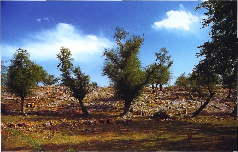
Govardhana
On the walking guideGovardhana is the hill that Kṛṣṇa lifted with one hand and held up for seven days, so that the people and cows of Vraja could shelter under it from Indra's rain.
Source details
printed: “Govardhana”
- 68
- 69
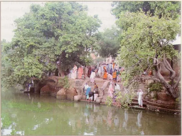
Gulāla-kuṇḍa
Gulāla-kuṇḍa is a pond near the village of Gāṅṭholī, west of Govardhana Hill, beside the road that comes from Jatīpurā.
Source details
printed: “Gulāla-kuṇḍa”
- 70
Gāṅṭholī
On the walking guideGāṅṭholī is a village west of Govardhana Hill, on the road from Govardhana to Ḍīg.
Source details
printed: “Gāṅṭholī”
- 71
Beheja
On the walking guideBeheja is a village on the road from Govardhana to Ḍīg (Dīrghapura), about six miles from Govardhana, according to the guidebook Śrī Vraja-maṇḍala Parikramā (2007).
Source details
printed: “Beheja”
- 72
Devaśīrṣa-sthāna
On the walking guideDevaśīrṣa-sthāna is one of Kṛṣṇa's cow-herding places, on the parikramā route from Beheja.
Source details
printed: “Devaśīrṣa”
- 73
Muniśīrṣa-sthāna
On the walking guideMuniśīrṣa-sthāna, now called Muḍaśerasa, lies west of Devaśīrṣa-sthāna on the parikramā route from Beheja, according to the guidebook Śrī Vraja-maṇḍala Parikramā (2007).
Source details
printed: “Muniśīrṣa”
- 74
Paramādanā
On the walking guideParamādanā is a village whose older name, the Bhakti-ratnākara says, is Pramodanā, because here Kṛṣṇa, in a playful mood, gave delight (pramoda) to the girls of Vraja.
Source details
printed: “Paramādanā”
- 75
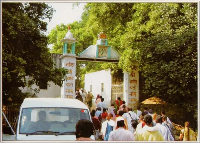
Ādi-badrī
Ādi-badrī, "the original Badarī", is a hill area on the western side of Vraja-maṇḍala, north of Setu-kandarā, with the village of Ālīpura at the foot of its hills.
Source details
printed: “Badrī-nārāyaṇa”
- 76
Godṛṣṭivana
On the walking guideGodṛṣṭivana, "the forest of looking at the cows", is a place of Kṛṣṇa's cow-herding, now the village of Guhānā.
Source details
printed: “Guhānā”
- 77
- 78
Ālīpura (Ādi-badrī)
On the walking guideĀlīpura is the village at the foot of the hills of Ādi-badrī; the guidebook Śrī Vraja-maṇḍala Parikramā (2007) says that the hills rise from it.
Source details
printed: “Ālīpura”
- 79
Ādi-badrī
Ādi-badrī, "the original Badarī", is a hill area on the western side of Vraja-maṇḍala, north of Setu-kandarā, with the village of Ālīpura at the foot of its hills.
Source details
printed: “Ādi-badrī”
- 80
Paśopā
On the walking guidePaśopā (Śrī Vraja-maṇḍala Parikramā (2007): Paśapa-gaon; the undated parikramā notes Ādi-Badrinātha: Pasopa) is a village in the hills on a pilgrims' route from Ādi-badrī and Ālīpura to Kāmyavana, five miles east of Ādi-kedāranātha, with a Jugala-kiśora temple on a hill above it.
Source details
printed: “Paśopā”
- 81
Kedāranātha (Vraja)
On the walking guideA hill-top Śiva shrine near Kāmyavana, called Kedāranātha or Ādi-kedāranātha, about six miles south-west of the town (Śrī Vraja-maṇḍala Parikramā (2007)), with the liṅga Kedāranātha Mahādeva and Pārvatī-devī in a cave (the undated parikramā notes Ādi-Badrinātha).
Source details
printed: “Kedāranātha”
- 82
Bilonda
On the walking guideA village that Śrī Vraja-maṇḍala Parikramā (2007) places two miles north-east of Kedāranātha, on a pilgrims' way Kedāranātha – Bilonda – Caraṇa-pahāḍī – Kāmyavana.
Source details
printed: “Bilonda”
- 83
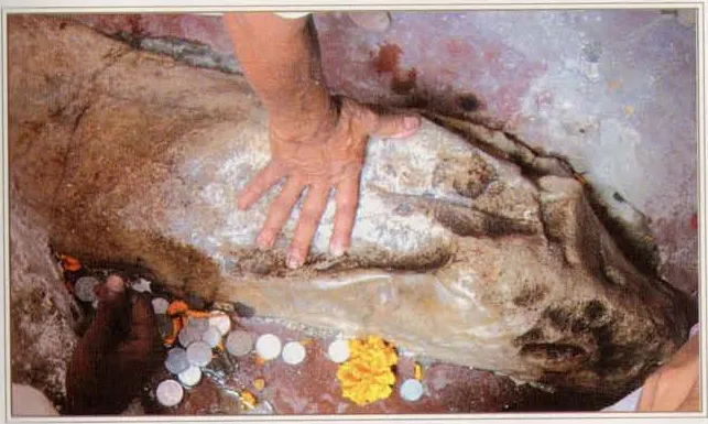
Caraṇa-pahāḍī (Kāmyavana)
Caraṇa-pahāḍī, "the hill of the feet", is a hill outside the town of Kāmyavana.
Source details
printed: “Caraṇa-pahāḍī”
- 84
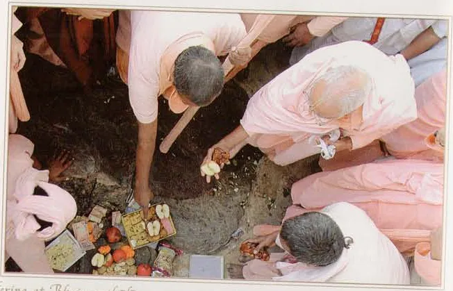
Bhojana-thālī (Kāmyavana)
On the walking guideBhojana-thālī, "the place of the meal plate", is a rocky hill in Kāmyavana, near Vyomāsura's cave.
Source details
printed: “Bhojana-thālī”
- 85
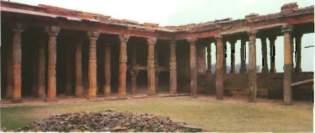
Kāmyavana
On the walking guideKāmyavana, also called Kāmavana, is one of the twelve forests of Vraja, around the town of Kāmā (Kāman).
Source details
printed: “Kāmyavana”
- 86
Bajerā
On the walking guideA village two miles east of Kāmyavana that Śrī Vraja-maṇḍala Parikramā (2007) calls the birthplace of the twin sakhīs Raṅgadevī and Sudevī, daughters of Raṅgasāra Gopa and Karuṇā Gopī, who live with Śrīmatī Rādhikā in Jāvaṭa.
Source details
printed: “Vajerā”
- 87
Sunaharā Kadamba-khaṇḍī
A kadamba grove that Śrī Vraja-maṇḍala Parikramā (2007) names among the places 'nearby' Kanovāro and, in its itinerary, between Vajerā and Ūñcāgaon.
Source details
printed: “Sunaharā Kadamba-khaṇḍī”
- 88
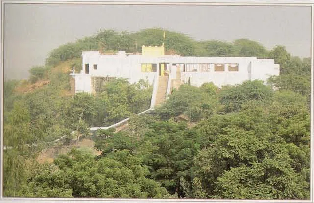
Ūñcāgaon
On the walking guideŪñcāgaon, the "high village", stands on the hill of Lalitā-sthala (Aṭorā-parvata), one mile west of Varṣāṇā, according to the guidebook Śrī Vraja-maṇḍala Parikramā (2007).
Source details
printed: “Ūñcāgaon”
- 89
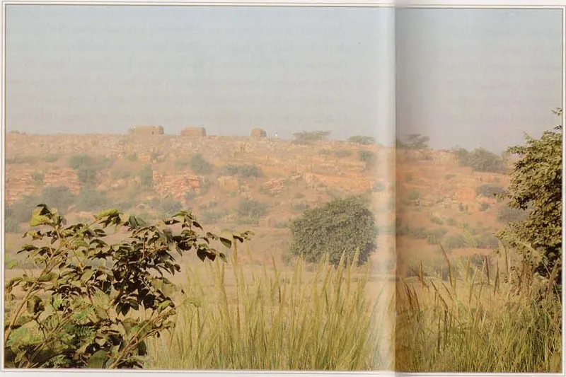
Sakhīgiri-parvata
Sakhīgiri-parvata, the hill of the sakhīs, is a low hill near Ūñcāgaon, which Śrīla Nārāyaṇa Bhaṭṭa Gosvāmī's Vraja-bhakti-vilāsa calls Lalitā-grāma, after Lalitā, Śrī Rādhā's foremost companion.
Source details
printed: “Sakhīgirī-parvata”
- 90
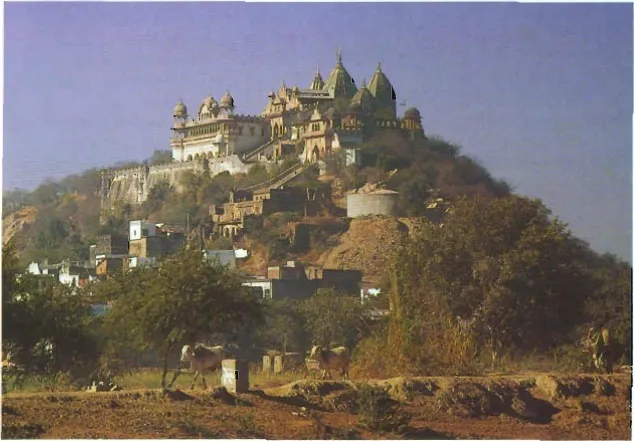
Varṣāṇā
On the walking guideVarṣāṇā is the town of Vṛṣabhānu, Śrī Rādhā's father, on and around the hill of Brahma-parvata.
Source details
printed: “Varsānā”
- 91
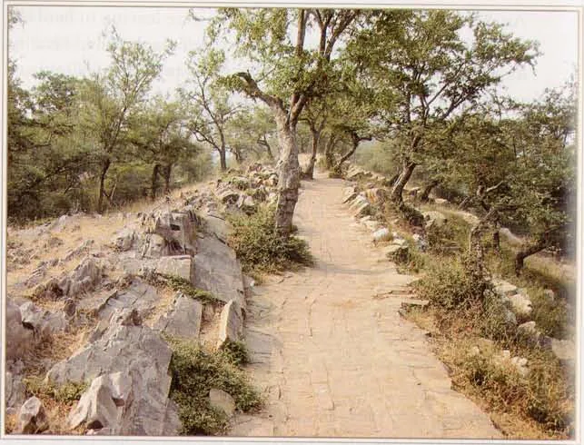
Gahvaravana (Varṣāṇā)
Gahvaravana, the forest of the hollow, is the wooded ground at the foot of the hill of Varṣāṇā.
Source details
printed: “Gahvaravana”
- 92
- 93
- 94
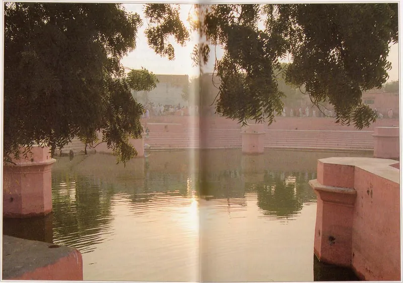
Prema-sarovara
On the walking guidePrema-sarovara, the lake of love (prema), lies on the road from Varṣāṇā to Nandagrāma, with the village of Gājīpura to its east.
Source details
printed: “Prema-sarovara”
- 95
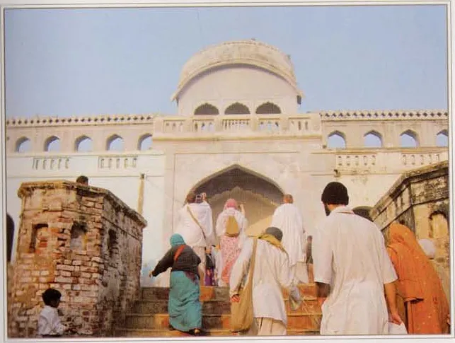
Saṅket
On the walking guideSaṅket is the village between Nandagrāma, Kṛṣṇa's home, and Varṣāṇā, the home of Śrī Rādhā.
Source details
printed: “Saṅket”
- 96
- 97
Meherāna-gaon
Meherāna is a village connected with Kṛṣṇa's uncle Abhinanda.
Source details
printed: “Meherāna”
- 98
Sātoyā
On the walking guideSātoyā, also called Satvāsa, is a village on the north-western border of Vraja, west of Meherāna-gaon.
Source details
printed: “Satvāsa”
- 99
- 100
Bhojana-thālī (Kāmyavana)
On the walking guideBhojana-thālī, "the place of the meal plate", is a rocky hill in Kāmyavana, near Vyomāsura's cave.
Source details
printed: “Bhojana-thālī”
- 101
- 102
- 103
Bichora
On the walking guideBichora is a village of Vraja whose name, according to the Bhakti-ratnākara, comes from viccheda, separation.
Source details
printed: “Bichoravana”
- 104
Vanacarī
On the walking guideVanacarī (Banacārī) is a village on the north-western border of Vraja.
Source details
printed: “Vanacarī”
- 105
Hoḍal
On the walking guideHoḍal is a village on the north-western edge of Vraja.
Source details
printed: “Hoḍal”
- 106
Daīgaon
On the walking guideDaīgaon, also written Dahīgaon, is a village three miles south of Hoḍal, according to the guidebook Śrī Vraja-maṇḍala Parikramā (2007).
Source details
printed: “Dahīgaon”
- 107
- 108
- 109
- 110
Sāñculī
On the walking guideSāñculī, four miles south of Hāroyāna and six miles north-west of Nandagaon, is known only from Śrī Vraja-maṇḍala Parikramā (2007), which names a temple of Candrāvalī Sakhī and a Sūrya-kuṇḍa there and says that Candrāvalī used to meet Kṛṣṇa here on the pretext of worshipping the Sun.
Source details
printed: “Sāñculī”
- 111
- 112
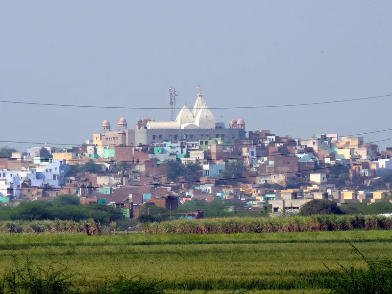
Nandagrāma
On the walking guideNandagrāma, today Nandagaon, is the village of Nanda Mahārāja, Kṛṣṇa's father in Vraja, on and around Nandīśvara Hill.
Source details
printed: “Nandagaon”
- 113
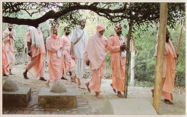
Ter-kadamba
On the walking guideṬer-kadamba is a kadamba tree and grove near Nandagrāma.
Source details
printed: “Kadamba-ṭer”
- 114
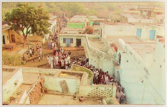
Jāvaṭa
On the walking guideJāvaṭa, also called Yāvaṭa or Yāva-grāma, is the village of Abhimanyu, his mother Jaṭilā and his sister Kuṭilā, where Śrī Rādhā lives in Kṛṣṇa's pastimes.
Source details
printed: “Jāvaṭa”
- 115
- 116
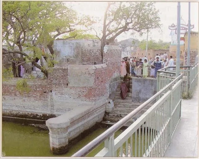
Kosī
On the walking guideKosī, also called Kosīvana, is a town on the Mathurā–Delhi road.
Source details
printed: “Kosī”
- 117
Paya-gaon
On the walking guidePaya-gaon, the Bhakti-ratnākara's Paya-grāma, is a village six miles east of Kosī, according to the guidebook Śrī Vraja-maṇḍala Parikramā (2007).
Source details
printed: “Payagaon”
- 118
Chatravana
On the walking guideChatravana is today the town of Chātā on the Mathurā–Delhi road, about twenty miles north-west of Mathurā, according to the guidebook Śrī Vraja-maṇḍala Parikramā (2007).
Source details
printed: “Chattravana”
- 119
Narī-Semarī
Narī-Semarī is a pair of villages south-east of Chātā (Chatravana).
Source details
printed: “Narī-Semarī”
- 120
Sāṅkhī
On the walking guideSāṅkhī is a village of Vraja connected with the killing of the demon Śaṅkhacūḍa.
Source details
printed: “Sāṅkhī”
- 121
Ārabāḍī
Śrī Vraja-maṇḍala Parikramā (2007) names Ārabāḍī only as a reference point: the village of Raṇavāḍī lies one mile north of it.
Source details
printed: “Ārabāḍī”
- 122
Raṇavāḍī
Raṇavāḍī is a village of Vraja one mile north of Ārabāḍī and three miles south-west of Chātā, according to the guidebook Śrī Vraja-maṇḍala Parikramā (2007); Bhaṇḍāgora lies two miles north-west of it.
Source details
printed: “Raṇavāḍī”
- 123
Bhaṇḍāgora
On the walking guideBhaṇḍāgora, now called Bhādāvalī, is a village two miles north-west of Raṇavāḍī, according to the guidebook Śrī Vraja-maṇḍala Parikramā (2007).
Source details
printed: “Bhādāvalī”
- 124
Khāṅpura
A village one mile south of Bhādāvalī where, according to Śrī Vraja-maṇḍala Parikramā (2007), Rādhā-Kṛṣṇa and the sakhīs ate various foods (khādya) after playing Holī at Raṇavāḍī.
Source details
printed: “Khāṁpura”
- 125
- 126
- 127
- 128
Karehlā
On the walking guideKarehlā is a village north of Kāmaī, in the area of Varṣāṇā.
Source details
printed: “Karehlā”
- 129
Pīsāī
Pīsāī is a village of Vraja one and a half miles north of Karehlā, according to the guidebook Śrī Vraja-maṇḍala Parikramā (2007).
Source details
printed: “Pesāī”
- 130
Ludhaulī
Ludhaulī is a village of Vraja that the Bhakti-ratnākara calls Ludhaunī: a residence of Lalitā, Śrī Rādhā's companion, known throughout Vraja.
Source details
printed: “Ludhaulī”
- 131
Āñjanauka
Āñjanauka is a village five miles south-east of Nandagrāma, according to the guidebook Śrī Vraja-maṇḍala Parikramā (2007), with a rāsa-maṇḍala and the Kiśorī-kuṇḍa.
Source details
printed: “Āñjanauka”
- 132
Khadiravana
Khadiravana, the forest of khadira trees, is one of the twelve forests of Vraja in every list found, on the western side of the Yamunā.
Source details
printed: “Khadīravana”
- 133
Bijavārī
On the walking guideBijavārī is a village one and a half miles south-east of Nandagrāma, according to the guidebook Śrī Vraja-maṇḍala Parikramā (2007).
Source details
printed: “Bijavārī”
- 134
Nandagrāma
On the walking guideNandagrāma, today Nandagaon, is the village of Nanda Mahārāja, Kṛṣṇa's father in Vraja, on and around Nandīśvara Hill.
Source details
printed: “Nandagaon”
- 135
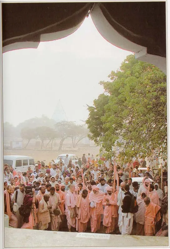
Kokilāvana
On the walking guideKokilāvana, the forest of the cuckoo (kokila), lies west of Jāvaṭa.
Source details
printed: “Kokilāvana”
- 136
Baiṭhāna
Baiṭhāna is a pair of villages, Baḍī-baiṭhāna and Choṭī-baiṭhāna, "big" and "little" Baiṭhāna.
Source details
printed: “Choṭī-baiṭhana”
- 137
Baiṭhāna
Baiṭhāna is a pair of villages, Baḍī-baiṭhāna and Choṭī-baiṭhāna, "big" and "little" Baiṭhāna.
Source details
printed: “Baḍī-baiṭhana”
- 138
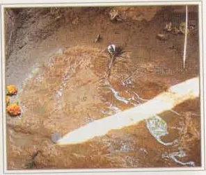
Caraṇa-pahāḍī (near Choṭī-baiṭhāna)
Caraṇa-pahāḍī, "the hill of the feet", is a small hill near Baiṭhāna; the guidebook Śrī Vraja-maṇḍala Parikramā (2007) places it one mile north of Choṭī-baiṭhāna.
Source details
printed: “Caraṇa-pahāḍī”
- 139
Rasaulī
Rasaulī is a village of Vraja between Caraṇa-pahāḍī and Koṭvana, according to the guidebook Śrī Vraja-maṇḍala Parikramā (2007).
Source details
printed: “Rasaulī”
- 140
Koṭvana
Koṭvana lies near the Delhi–Mathurā highway between Kosī and Hoḍal, according to the guidebook Śrī Vraja-maṇḍala Parikramā (2007).
Source details
printed: “Koṭvana”
- 141
Khāmī-gaon
Khāmī-gaon, also called Khambahara, is a village on the north-western border of Vraja, four miles north-east of Hoḍal and near the village of Vanacarī, according to Śrī Vraja-maṇḍala Parikramā (2007).
Source details
printed: “Khāmī”
- 142
Śeṣaśāī
Śeṣaśāī, or Śeṣaśāyī, "the Lord who lies on Śeṣa", is a village at the northern edge of Vraja.
Source details
printed: “Śeṣaśāī”
- 143
- 144
- 145
- 146
Ūjānī
Ūjānī lies, according to the guidebook Śrī Vraja-maṇḍala Parikramā (2007), near the main road between Chātā and Śergarh, about four miles north-east of Paya-gaon; the position may need checking on the ground.
Source details
printed: “Ūjānī”
- 147
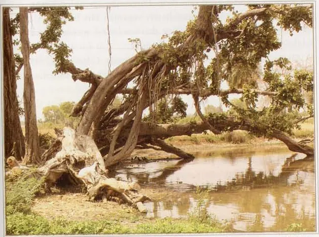
Khelanvana
Khelanvana, "the forest of play", lies at Śergarh on the Yamunā, two miles south-east of Ūjānī, according to Śrī Vraja-maṇḍala Parikramā (2007).
Source details
printed: “Khelanavana”
- 148
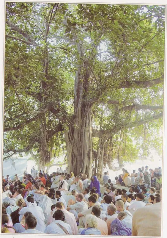
Rāma-ghāṭa
Rāma-ghāṭa is a place on the Yamunā near Śergarh, honoured as the place of Balarāma's rāsa dance with the gopīs and of His dragging of the Yamunā with His plough, during His two months' visit to Vraja.
Source details
printed: “Obe”
- 149
Rāma-ghāṭa
Rāma-ghāṭa is a place on the Yamunā near Śergarh, honoured as the place of Balarāma's rāsa dance with the gopīs and of His dragging of the Yamunā with His plough, during His two months' visit to Vraja.
Source details
printed: “Rāma-ghāṭa”
- 150
- 151
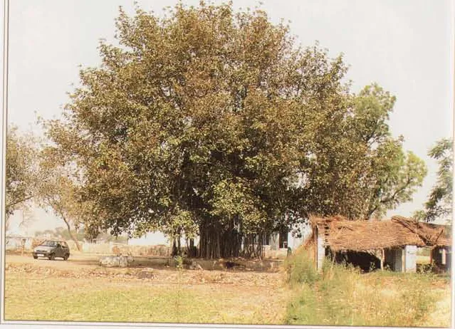
Akṣayavaṭa (near Rāma-ghāṭa)
Akṣayavaṭa, "the imperishable banyan", stands near Rāma-ghāṭa on the Yamunā.
Source details
printed: “Akṣayavaṭa”
- 152
Gopī-ghāṭa (Tapovana)
Gopī-ghāṭa is the bathing place on the Yamunā at Tapovana.
Source details
printed: “Gopī-ghāṭa (Tapovana)”
- 153
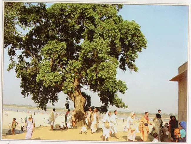
Cīra-ghāṭa (near Śergarh)
This Cīra-ghāṭa is a bathing place on the Yamunā up the river from Vṛndāvana, near Śergarh.
Source details
printed: “Cīra-ghāṭa”
- 154
- 155
Bhaiyā
Bhaiyā, or Bhaya-gaon, is a village close to Nanda-ghāṭa on the Yamunā, two miles south of Gāṅgralī, according to the guidebook Śrī Vraja-maṇḍala Parikramā (2007).
Source details
printed: “Bhaya-gaon”
- 156
- 157
Hājarā-gaon
Hājarā-gaon is named by Śrī Vraja-maṇḍala Parikramā (2007) only as the village from which Barāhara (Barārā) lies a mile to the south-west, and in its route list; no other usable source names it or tells a pastime or history for it.
Source details
printed: “Hājarā”
- 158
Bālahārā
Bālahārā is a village whose name, according to the guidebook Śrī Vraja-maṇḍala Parikramā (2007), joins bāla, "boy", and harnā, "to steal": here Brahmā stole away Kṛṣṇa's cowherd friends.
Source details
printed: “Balīhārā”
- 159
Bājanā
Bājanā is named by Śrī Vraja-maṇḍala Parikramā (2007) only as the village from which Unāī (Janāī-gaon) lies a mile and a half south, and in its route list; no other source found names it as a place of Vraja or tells a pastime or history for it.
Source details
printed: “Bājanā”
- 160
- 161
Śakaroyā
Śakaroyā is a village whose name recalls Śakra, a name of Indra, the king of heaven.
Source details
printed: “Śakaroyā”
- 162
Āṭasa
Āṭasa is a village six miles from Vṛndāvana, according to the guidebook Śrī Vraja-maṇḍala Parikramā (2007).
Source details
printed: “Āṭāsa”
- 163
- 164
Parkhama
Parkhama, the Bhakti-ratnākara's Parikhama, is a village one mile west of Janāī-gaon, according to the guidebook Śrī Vraja-maṇḍala Parikramā (2007).
Source details
printed: “Parkhama”
- 165
Caumā
On the walking guideCaumā, formerly Caumuṅhā, is a village on the Mathurā–Delhi road about eight miles from Mathurā and one mile west of Parkhama, according to the guidebook Śrī Vraja-maṇḍala Parikramā (2007).
Source details
printed: “Caumā”
- 166
Ajhaī
Ajhaī is a village about a mile from Caumuṅhā (Caumā) on the Mathurā–Kosī road where, according to Śrī Vraja-maṇḍala Parikramā (2007), an ancient deity of Brahmā can be seen; Mītal (1966) describes a four-faced image of Brahmā there.
Source details
printed: “Ajaī”
- 167
Seyāno
Seyāno is a village of Vraja whose name, according to the Bhakti-ratnākara, recalls the killing of the python-demon Aghāsura.
Source details
printed: “Siṅhānā”
- 168
- 169
Pasaulī
Pasaulī, also called Sapaulī, Aghavana and Sarpasthalī, "the place of the serpent", is a village two miles north-west of Parkhama, according to the guidebook Śrī Vraja-maṇḍala Parikramā (2007).
Source details
printed: “Pasaulī”
- 170
- 171
- 172
- 173
Seī
On the walking guideSeī is a village of Vraja connected with Lord Brahmā's bewilderment.
Source details
printed: “Seī”
- 174
Māī
Māī is named by Śrī Vraja-maṇḍala Parikramā (2007) only as one of two villages, Māī and Basāī, a mile and a half north-east of Seī; no other usable source names it or tells a pastime or history for it.
Source details
printed: “Māī”
- 175
Basāī
Basāī is named by Śrī Vraja-maṇḍala Parikramā (2007) only as one of two villages, Māī and Basāī, a mile and a half north-east of Seī; no other usable source names it or tells a pastime or history for it.
Source details
printed: “Basāī”
- 176
Bhadravana
Bhadravana is one of the twelve forests of Vraja, and one of the five that lie across the Yamunā from Vṛndāvana, on its eastern bank.
Source details
printed: “Bhadravana”
- 177
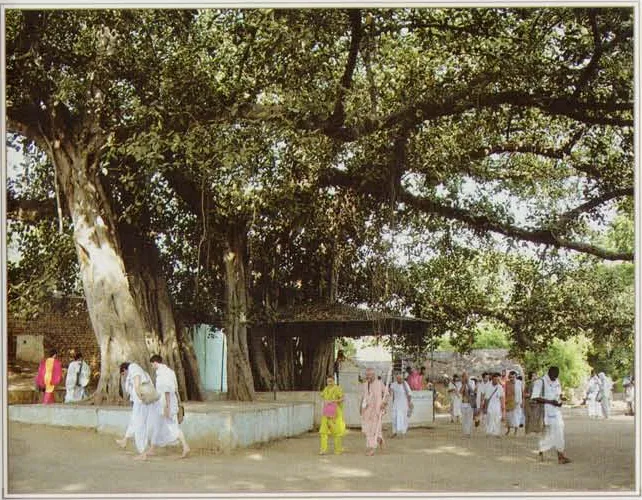
Bhāṇḍīravana
Bhāṇḍīravana, the forest of the Bhāṇḍīra banyan, is one of the twelve forests of Vraja, and Śrīla Prabhupāda counts it among the five forests on the eastern bank of the Yamunā.
Source details
printed: “Bhāṇḍīravana”
- 178
Māṭa-gaon
On the walking guideMāṭa, also called Māṭa-gaon or Māṅṭa-gaon, is a village of Māṭavana on the far side of the Yamunā from Vṛndāvana.
Source details
printed: “Māṭa”
- 179
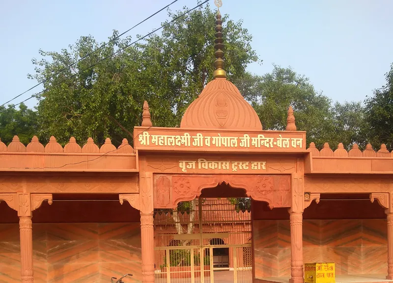
Bilvavana
Baelvana, in Sanskrit Bilvavana, "the forest of bilva (bael) trees", is one of the twelve forests of Vraja.
Source details
printed: “Baelvana”
- 180
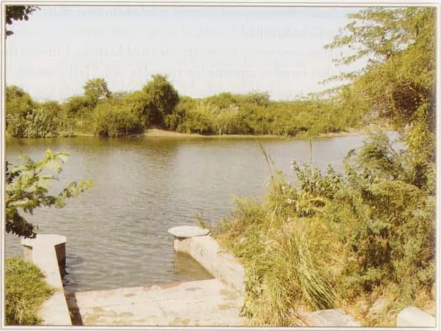
Māna-sarovara (Māṭavana)
On the walking guideMāna-sarovara is a lake across the Yamunā from Vṛndāvana, near the village of Pānī-gaon.
Source details
printed: “Māna-sarovara”
- 181
Āgiyārā-gaon
Āgiyārā-gaon, also called Ārā, is a village south-west of Kāśraṭa.
Source details
printed: “Ārā”
- 182
Pānī-gaon
On the walking guidePānī-gaon, also known as Pānī-ghāṭa, is a village on the bank of the Yamunā across the river from Vṛndāvana, in the forest of Māṭavana, according to the guidebook Śrī Vraja-maṇḍala Parikramā (2007).
Source details
printed: “Pānīgaon”
- 183
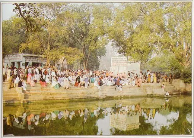
Lohavana
On the walking guideLohavana is one of the twelve forests of Vraja, across the Yamunā from Mathurā.
Source details
printed: “Lohavana”
- 184
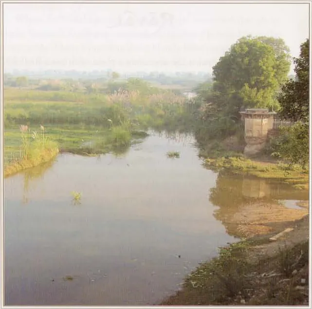
Rāval
On the walking guideRāval (Rāvala) is a village of the Mahāvana region, across the Yamunā from Mathurā.
Source details
printed: “Rāval”
- 185
- 186
Āyore-grāma
On the walking guideĀyore-grāma is a village near Lohavana, according to the guidebook Śrī Vraja-maṇḍala Parikramā (2007).
Source details
printed: “Āyaro”
- 187
- 188
Bandī-Ānandī
On the walking guideBandī-Ānandī is a village a short distance south of Lohavana, on the pilgrims' route to the town of Dāūjī (Baldeo).
Source details
printed: “Bāṅdī”
- 189
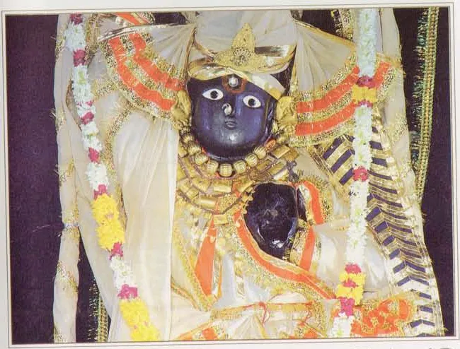
Dāūjī (village)
Dāūjī, also called Baldeo or Baladeva, is the village of the Deity of Balarāma known in Vraja as Dāūjī.
Source details
printed: “Dāūjī”
- 190
- 191
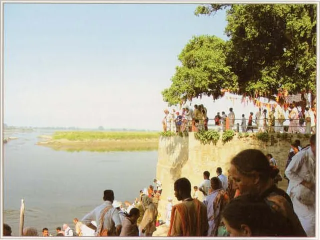
Brahmāṇḍa-ghāṭa
Brahmāṇḍa-ghāṭa is a bathing place on the Yamunā in Mahāvana.
Source details
printed: “Brahmāṇḍa-ghāṭa”
- 192
Cintāharaṇa-ghāṭa
Cintāharaṇa-ghāṭa is a bathing place on the Yamunā in Mahāvana, near Brahmāṇḍa-ghāṭa.
Source details
printed: “Cintāharaṇa-ghāṭa”
- 193
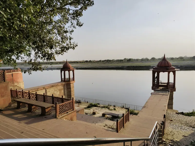
Mahāvana
Mahāvana, "the great forest", also called Bṛhadvana, is the forest on the eastern bank of the Yamunā where Kṛṣṇa spent His infancy.
Source details
printed: “Mahāvana”
- 194
Gokula (present village)
On the walking guideGokula is a village on the bank of the Yamunā near Mahāvana, the seat of the gosvāmīs of the Vallabha-sampradāya, called the Gokula gosvāmīs according to the guidebook Śrī Vraja-maṇḍala Parikramā (2007).
Source details
printed: “Gokula”
- 195
- 196
- 197
Nauraṅgabāda
A village across the Yamunā from Gokula, on the way back to Mathurā, with a temple of Śrī Gaṅgājī and other places of darśana (Śrī Vraja-maṇḍala Parikramā (2007), pp. 534 and 25).
Source details
printed: “Nauraṅgābād”
- 198
Mathurā
On the walking guideMathurā is the city on the Yamunā where Śrī Kṛṣṇa appeared from Devakī in the prison of King Kaṁsa.
Source details
printed: “Mathurā”
- 199
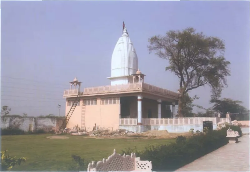
Akrūra-ghāṭa
Akrūra-ghāṭa, also called Akrūra-tīrtha, is a bathing place on the old bank of the Yamunā, on the road between Vṛndāvana and Mathurā.
Source details
printed: “Akrūra-ghāṭa”
- 200
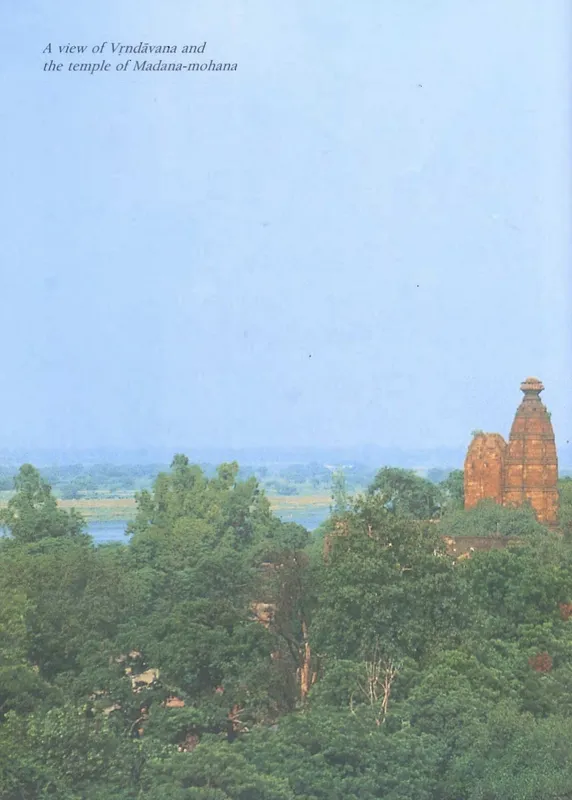
Vṛndāvana
On the walking guideVṛndāvana is the forest on the bank of the Yamunā where Kṛṣṇa spent His childhood and youth, and the town of temples that stands in that forest today.
Source details
printed: “Vṛndāvana”
- 201
Aṭalavana
Aṭalavana is, according to Śrī Vraja-maṇḍala Parikramā (2007), the first of the twelve forests within Vṛndāvana's ten-mile parikramā, in the south of the town near the junction of the Mathurā road and the parikramā path.
Source details
printed: “Bhātrol (Aṭalavana)”
- 202
Kevārivana
Kevārivana is one of the old forests within the parikramā (the walk around the town) of Vṛndāvana, north-west of Aṭalavana, and the forest of Dāvānala-kuṇḍa.
Source details
printed: “Kyārīvana”
- 203
Vihāravana (Vṛndāvana)
The third of the twelve forests that Śrī Vraja-maṇḍala Parikramā (2007) lists inside the ten-mile Vṛndāvana parikramā, south-west of Kevārivana, containing Rādhā-kūpa and near the āśramas of Ramaṇa-retī; Śrī Vraja-maṇḍala Parikramā (2007) tells no pastime of it and gives no reason for its name.
Source details
printed: “Vihāravana”
- 204
Gocāraṇavana
Gocāraṇavana is one of the twelve forests of Vṛndāvana listed by Śrī Vraja-maṇḍala Parikramā (2007), on the old Yamunā bank west of Vihāravana in the south-west of the town, containing the Varāha temple and Gautama Muni's āśrama.
Source details
printed: “Gocāraṇavana”
- 205
Kāliya-damanavana
Kāliya-damanavana, "the forest of the subduing of Kāliya", is one of the twelve small forests within the parikramā (the walk around) of Vṛndāvana town.
Source details
printed: “Kālīya-damanavana”
- 206
Gopālavana
Gopālavana is one of the twelve small forests within the parikramā (the walk around) of Vṛndāvana town.
Source details
printed: “Gopālavana”
- 207
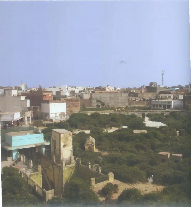
Sevā-kuñja
On the walking guideSevā-kuñja, "the grove of service", is a walled garden in the centre of Vṛndāvana.
Source details
printed: “Nikuñjavana (Sevā-kuñja)”
- 208
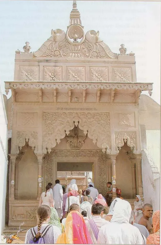
Nidhuvana
On the walking guideNidhuvana is a walled grove in Vṛndāvana town, north of Sevā-kuñja.
Source details
printed: “Nidhuvana”
- 209
Rādhāvana
Rādhāvana, also called Rādhā-bāga, is a grove in the north-east corner of Vṛndāvana town, on the bank of the Yamunā.
Source details
printed: “Rādhāvana (Rādhā-bāga)”
- 210
Jhūlanavana
Jhūlanavana, the "swing forest", is the tenth of the twelve forests (vanas) that the guidebook Śrī Vraja-maṇḍala Parikramā (2007) counts inside the ten-mile parikramā of Vṛndāvana town.
Source details
printed: “Jhūlanavana”
- 211
Gahvaravana (Vṛndāvana)
Gahvaravana is a forest in the east of Vṛndāvana town, south of Jhūlanavana.
Source details
printed: “Gahvaravana”
- 212
Papaḍavana
Papaḍavana is the twelfth and last of the twelve small forests that lie within the ten-mile parikramā (the walk around) of Vṛndāvana town, according to the guidebook Śrī Vraja-maṇḍala Parikramā (2007).
Source details
printed: “Papaḍavana”
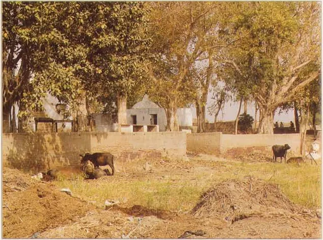
References
- Śrī Vraja-maṇḍala Parikramā (2007), list of the places visited on Vraja-maṇḍala parikramā, pp. 22–25
- Śrīla Prabhupāda, Śrī Caitanya-caritāmṛta, Madhya-līlā 21.29, purport · vedabase.io
- Vṛndāvana-Dhāma Ki Jaya! (c. 1986), by Dhruva Mahārāja dāsa, Introduction, p. vi